Location.
Convict Spring is about 5 miles northeast of Mayo
on the southwest side of the Suwannee River. From Mayo drive 5 miles east
on U.S. Hwy 27 to State Hwy 354. Go 2 miles on paved road until the road
starts curving sharply to the left. Continue right and follow the signs to
Jim Hollis's River Rendezvous. There are several signs pointing the way.
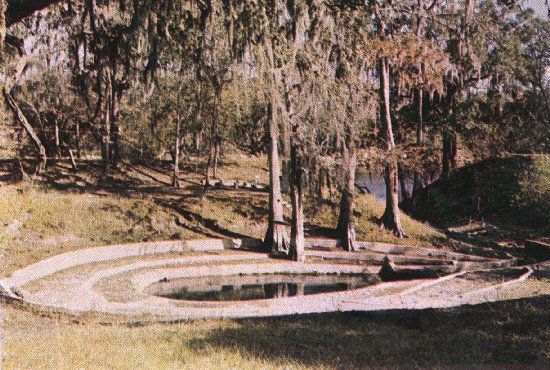
Description.
Convict Spring vent is in the northern part of the
three-tiered cement teardrop. In the early 1900's, this site was used to
house chain gang prisoners. Pool depth averages 6 ft except near the constriction
where the run begins, and at the vent opening into the cave where the pool
is 20 ft deep. The run flows east from the spring about 50 ft to the Suwannee
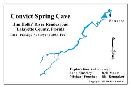
River. This is a closed site to cave diving since penetration goes only
about 90 feet with doubles. Some side mount exploration has been conducted
here with everything check out and mapped. Max depth is about 36 feet throughout
the entire system with visibility usually 10 or less due to high bacteria
content. Diving is no longer allowed at this recreational park. Mike Poucher has
done some work in this system and has a website providing information
here.
Click here for Convict Springs cave stick
map (PDF)
Click here for Convict Springs cave map (PDF)
Click here for a view of Mike Poucher's map of Convict Springs
Return to Florida Cave, Caverns, and Sinkholes